

Butterfly Zoo, Indoors Adventure & Outdoors MiniGolf courses open daily from 10 am to 3 pm last entry


How to find us
Location
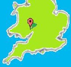
Find us at
- Postcode: HR9 6DA (“Symonds Yat” won’t work)
- What3words: ///stag.relatives.love
- Ordnance Survey grid ref: SO 553175
- Latitude 51° 51’ 14” N, Longtitude 2° 39’ 01” W
Choose your transport method:
Road | Taxi | Hike or Bike | Rail | Bus
Road
- Take the A40 between Ross-on-Wye and Monmouth.
- Exit the A40 at Whitchurch.
- Turn south onto the B4164 towards Symonds Yat West for 100 yards.
- At the roundabout take the B4164 south towards Symonds Yat West.
- After 150 yards turn left into our car park.
Lorries, coaches, buses, and vehicles over 7.5 T prohibited on B4432 Yat Rock to Huntsham bridge, Goodrich: Gradient 1:5, narrow road. Follow signs from BERRY HILL for alternate route.
Taxi
These local taxi services can carry a few bicycles:
- 01600 890998 JMC Taxis, Whitchurch (closest to Symonds Yat West);
- 0782 8882432 Kenny’s Taxis, Monmouth;
- 01600 712200 Amber Cars Travel, Monmouth;
- 01594 834834 CDS Taxis, Coleford;
- 01594 836757 Sovereign Taxis, Coleford.
The following services can’t transport bikes:
- 01989 566246 S & R Taxis, Ross-on-Wye;
- 01989 768738 Daz’s Taxis, Ross-on-Wye;
- 01989 563297, Alan’s Taxis, Ross-on-Wye.
Rail
Symonds Yat station closed to passengers in 1959, so use the National Rail planner to get to Newport, Gloucester or Hereford, then take the bus…
Bus
Either
a. Use the Traveline planner to get to Whitchurch, then:
From the Whitchurch, Crown Hotel/Tower Stores bus stop walk over the bridge over the A40 towards Symonds Yat West for 100 yards to the roundabout;
From the Whitchurch, Roundabout/School bus stop walk south along the B4164 towards Symonds Yat West for 150 yards, then turn left into the Wye Valley Visitor Centre.
or
b. Use the Traveline planner to get to Symonds Yat Rock, Gloucestershire; Descend to Symonds Yat East and cross the River Wye pedestrian ferry; Follow the track and footpath upstream as far as the churchyard; turn left towards the B4164 and cross the footbridge into the Wye Valley Visitor Centre.
Hike or Bike
Find us on:
Landranger sheet 162 1:50,000 Gloucester & Forest of Dean;
Outdoor Leisure sheet 14 1:25,000 Wye Valley & Forest of Dean.
You can cross the ferry from Symonds Yat East to reach us from
National Cycle Route 423 Peregrine Path.
There are trails and rides to us (mostly car-free) from:
Biblins Youth Campsite, Braceland Adventure Centre, Holly Barn Adventure Centre or Welsh Bicknor Youth Hostel;
Camping in the Forest, Doward Park and Riverside Campsites, and Forest Holidays;
Goodrich Castle, Symonds Yat East or Yat Rock; Monmouth
Users must exercise their own judgement about suitability and seasonality of routes, cross-country and traffic hazards. Safety on wilderness trails depends on personal capability and navigation skills. Ferries from Symonds Yat East close when the river is high and in winter. Users of GPS enabled apps may experience significant loss of signal in woodland and in the Upper Wye Gorge.